Monday, January 22, 2018

Talking About Water With University of Washington Students


Bright and somewhat early on Thursday morning I arrived at Kaikondrahalli Lake where Shubha was to give a presentation to students from the University of Washington – Seattle (USA). Shubha and I, along with another Biome Trust volunteer, met approximately twenty students plus their five advisors – two from the US and three from Bangalore – to discuss all things water-related. The students are here in Bangalore as part of an immersive study abroad course which focuses on sustainable international development and design thinking. Their topics range from waste management to urban development to education to water security – all learned through visits with local organizations working in those sectors.

Once we were all situated at the amphitheater, the students were given a brief history of Bangalore and its water story – the source rivers, construction of tanks for dry season storage and flood reduction, pollution problems, rain distribution, etc. With that context, we moved onto the story of Biome and how it evolved into what it currently is. From the early days as Rainwater Club to Biome Environmental Pvt. Ltd. and Biome Environmental Trust and the various roles each group plays within the water sector. We walked around the lake a bit more during which time the students asked about the wetlands, our projects, and anything else that came to mind. 


As someone who experienced the same visit during the second week of my stay in India, it was fun to go back and see it from the other perspective. I hadn’t realized just how much I had experienced and learned until I started answering some of the questions students had, though it also reminded me how complex these issues are and how much I have yet to learn.
Our next stop was a nearby school complex which included both government and non-government classrooms. Biome Trust had previously done some work at the school with another group of students from Washington to design and install a rainwater harvesting system. Following this project, the government became more active in providing for the school they finance.


The last stop of the day was Rainbow Drive, a planned layout off Sarjapur Road. We sat in the clubhouse while I explained a bit about how the layout developed and addressed their water concerns. When the borewells started going dry, the layout began relying on more tankers to provide water. Because this was expensive and detrimental in the long-term, they began looking for alternatives. With help from Biome, a graduated tariff was decided upon and individual homes were charged for their use based on a meter in order to manage the demand. Almost every home also has rainwater harvesting for either storage/use or for recharge. Additionally, there are recharge wells throughout the layout – several small ones in the drains and about five larger ones. With the lower demand and increased shallow aquifer levels from recharge, the layout began to see cost savings. This cost savings was used to help finance a phytorid water treatment plant for the layout.

All of these practices were observed and discussed during a short tour of the site, with the students asking questions along the way. Rainbow Drive is now an example we use for those who are interested in water management and learning what actions they can take.
-Alana, Project Intern

Wednesday, January 10, 2018

The girls of Umthli school in Meghalaya win a Basketball match

Umthli Secondary School in Meghalaya was one of the schools where BIOME helped implement Rainwater Harvesting along with several other groups. The implementation team also gifted the school a football as the students were very interested in football as well as very good at it. They were short of a football too.
Today, the sports teacher writes in with a note of thanks and a picture of the sub junior girls team that is playing Chennai today in the finals of the Reliance Foundation School Football , in Mumbai. The BIOME team is now rooting for the Umthli girls to win. How we connect in various ways !! And yes Rainwater Harvesting is always there - to be happy about. It rained and their tanks filled up too  The match is streaming live at http://www.rfyouthsports.com/football-2017/matchcentre-5753


A LAKE as a WETLAND or a WATER BODY : Re-imagining a lake as GREEN

Our preferred imagination of an urban lake is mostly blue water with a well maintained walking track all along, some trees on the periphery and some birds on them too. That imagination is of course broken when the lake stinks, froths, has plastic strewn around. That imagination is ALSO broken when we see overgrown typha reeds in the lake, floating hyacinth and alligator weed. When the lake turns from BLUE to GREEN that imagination is broken. And then we want to rejuvenate the lake and turn it BLUE again
If we were to step back and think why is it that we really want the BLUE or for that matter the WATER for, we realise a couple of things. These lakes were man made, created for purposes of flood control, irrigation, fishing, for live stock, for domestic purposes. However in most urban lakes, (especially the smaller ones) even if the water was of good quality
- we are not allowed to swim or bathe
- we are not allowed to fish unless we are a fishing contractor (with permissions from the fisheries department)
- we are not allowed to row a boat
- we are not allowed to immerse idols or other offerings. Immersions are to be made in a Kalyani that is specifically made for the purpose
The above aside (things that we cannot do), what purposes does the lake continue to serve us
- it still serves very well as a flood control mechanism when the streams do connect to the lake (and the flows are not obstructed)
- it allows for groundwater recharge and places nearer the lake do observe an increase in ground water tables
- helps regulate temperature. The area around a lake is always much cooler
- is a pleasant place to walk around/socialise
- provides spaces for birds, reptiles and other living beings to breed and nest
- is a place where societies/governments let in their treated/untreated waste water
- is a place where grass as fodder mostly grows abundantly and allows for cattle grazers to collect cattle feed
The above purposes could largely be met even if all or more of the lake were more of a GREEN wetland not a BLUE water body. Birds and reptiles prefer the WETLANDS for nesting and stay in the WETLANDS for large parts of the day. There are fishes in the WETLANDS too. Infact WETLANDS provide for a lot more bio diversity. The green in the WETLANDS possibly increases the oxygen levels in the surrounding areas too. The nutrient in the waste water is drawn out by the WETLAND plants and hence the water leaving the WETLAND is a lot cleaner
Given that we cant swim, bathe, fish, wash in the lake. Given that a GREEN WETLAND serves almost all and more of the purposes that a BLUE WATER BODY can, except for changes in aesthetics and some changes in volume. Given that we are increasingly looking at lakes as being receptacles for treated/untreated waste water and that we are also struggling to maintain our STPs in the long term, what if we imagined more of our lakes as WETLANDS and not WATER BODIES. Would that be ok ? The WETLANDS would serve almost all the functions that the current water body does and additionally allow for better water treatment too. Currently most lakes have 1/8 to 1/4 of the total area as a WETLAND - either by design and maintenance or by the propensity of the WETLAND to take over. It does seem a lot more practical and long term and realistic to imagine our lakes as GREEN WETLANDS rather than BLUE WATER bodies. This could mean that more of the lake area could turn green or perhaps some lakes could turn completely into WETLANDS too. The WETLAND would still need maintenance and management (and we would need to learn how to go about with it) and acceptance.
Would we be ok imagining our lakes as WETLANDS. More GREEN and less BLUE ?
All WETLAND and WATER BODY pictures from Lower Ambalipura Lake, Off Sarjapura Road. Roughly 20% WETLAND and 80% WATER BODY, by area


Cleaning a Well in Mathikere

Ravi and Shankar are well cleaners and well diggers. One of the wells that Shankar and Ravi are cleaning in Mathikere, Bangalore is 30ft deep and 3.5ft in diameter. Has water at 8ft below ground level. That means the well has a standing 22ft column of water. This translates to an availability of 4000 litres of water per day for the family. The well is 25 years old and the family uses the water for all non potable purposes. For drinking and cooking they have Cauvery water. The well has never gone dry. This is possibly because the family also lets in rooftop water into the well. So the well is used for ground water recharge as well as a source of water. An open well in a house really does make you a lot more responsible in the way you think of/use water. If anyone is looking to clean/dig a well in/around Mathikere, Shankar is on 96558 52399 and Ravi on 98805 53136


A map of the 6 rivers arising from the Nandi Hills

6 Rivers

thanks Anand S R Yadwad

Click on the map to read up details on each of the rivers


Tuesday, December 12, 2017

Rachenahalli Lake Report

Authored by Shreyas Sati and Alana Helin as part of the BIOME Trust Wetlands & Lakes Project

Summary
Rachenahalli Lake is on approximately 104 acres and is located in the north of Bangalore near the Embassy Manyata Business Park. The lake lies within the Yellamallappa Chetty Lake series within the Hebbal Valley. It is frequented by local residents who enjoy the provided walking path and park. During our visit on 7 November 2017, we observed that no STP exists in this lake; however, a well-demarcated area of wetland exists to the north of the lake. There are seven inlets - one into the wetland area, four from the wetland area into the main lake, and the other two directly into the main lake through naala overflow structures - and two outlets from the lake. The inlets carry a mixture of storm and sewage water. The volume of inflow through the inlets could not be determined.


Map 1


Overview and Observations
Rachenahalli Lake is located in Thanisandra, Bangalore.


Lake Area
104 acres
STP & Wetlands
No STP exists in the lake premises, however a 2.5 acre natural wetland exists to the northern side of the lake.

In 2016, Rachenahalli Lake was transferred from BDA to BBMP jurisdiction. Both prior to and after this change, the community group Jalamitra (founded in August 2015) has been active in the rejuvenation efforts.

It was observed that there is one inlet into the wetland and six inlets into the lake. From the wetland, there are four overflow inlets into the lake. The other two inlets are both naala overflows which will carry a mix of stormwater and sewage into the lake during flood events.

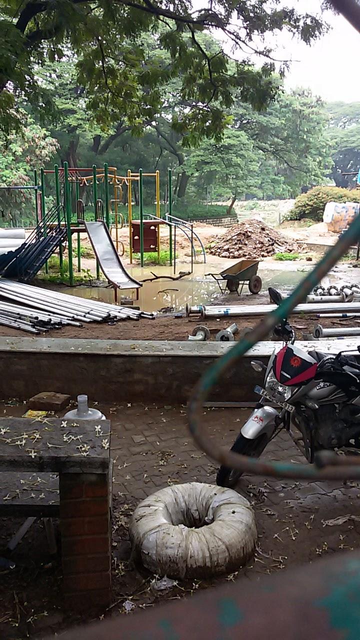
In the mornings and evenings, local residents use the path around the western, northern, and eastern edges of the lake for walking, jogging, or other workouts while also visiting the park along the western side of the lake. The park was under construction at the time of our visit and includes the following amenities: a gazebo, toilets, an office, a yoga platform, and a kalyani, as well as several benches.
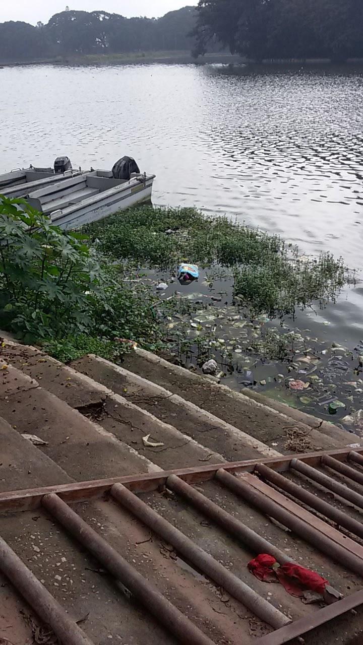

The Lake
One wetland inlet and six inlets where water would directly enter Rachenahalli Lake were identified and are summarized below.

Wetland Inlet
Name
Description
Photos
1
Wetland Inlet
Overflow of storm and sewage water from Naala 1 enters into the wetland area in the north of the lake.
Lake Inlet
Name
Description
Photos
1
Wetland Overflow 1
After entering the wetland, any remaining flood water overflows across the bund and enters the lake. 

2
Wetland Overflow 2
After entering the wetland, any remaining flood water overflows across the bund and enters the lake.
3
Wetland Overflow 3
After entering the wetland, any remaining flood water overflows across the bund and enters the lake.
4
Wetland Overflow 4
After entering the wetland, any remaining flood water overflows across the bund and enters the lake.
4
Naala 1 Overflow
Naala 1 will also overflow into the lake through a structure under the walking path to the north of the park.

6
Naala 2 Overflow
Naala 2, carrying water from the area west of the lake, will pass through an overflow structure during flood events and enter into the lake


The two outlets from the lake are both overflow systems under bridges in the south of the lake. At both outlets, particularly outlet 1, there was noticeable green hue to the water exiting the lake (see photos below). We also observed what appeared to be raw sewage mixing with the water just beyond lake outlet 1.


Pictured above: Overflow Outlet 1 from Rachenahalli Lake


Pictured above: Overflow Outlet 2 from Rachenahalli Lake

There was minimal buildup of algae on the water surface, though there was a noticeable green hue to the water near the outlets. In the center of the lake, the depth may reach about 10-11 feet.

Along the walking path, there is a park on the western side of the lake. Within the park are various amenities such as benches, toilets, a gazebo, a kalyani, and a yoga platform (see Map 1 for locations).

The STP
At present, no STP exists at Rachenahalli Lake.


The Wetland
There is a 2.5 acre natural wetland at Rachenahalli in the north corner of the lake which  accounts for about 2.4% of the total lake area. The wetland is separated from the main lake by a bund, through which is a bridge under which water will flow from the wetland into the lake.

The wetland also has a large number of wetland plants throughout.

Wetland pictured above


 References

Monday, December 4, 2017

Ulsoor Lake Report


Authored by Shreyas Sati and Alana Helin as part of the BIOME Trust Wetlands & Lakes Project

Summary
Ulsoor Lake is on 125 acres and is located very close to the central part of Bangalore by Kensington Road, Annaswamy Mudaliar Road, and Bhaskaran Road in Ulsoor, Bangalore. It is frequented by many local residents who enjoy the provided walking path, gym, kalyani, and other amenities. As of our visit on 6 October 2017, a 2 MLD STP is being constructed on the northeast side of the lake by Euro Tech Company1,2. At this point in time, not much information is known about the STP. There are no wetlands in the lake. The volume of inflow through the inlets could not be determined.


Overview and Observations
Ulsoor Lake is located in Ulsoor, Bangalore.

20171006_080615.jpg

Lake Area
125 acres
STP
A 2 MLD STP is being constructed by Euro Tech Company on the northeast side of the lake.

The Madras Sappers (MEG) have played an important role in rejuvenating the lake. Also, the Prestige Group have assumed some responsibilities in the rejuvenation, maintenance, and security of the lake. There is one primary inlet through which the sewage from the naala in the north overflows during a flood event into that part of the lake which is separated by a bund. The bund acts as a silt trap, which stops and removes plastic, silt, and other debris from the sewage before the sewage enters into the main part of the lake. The only outlet from the lake is located in the south.

There is a kalyani in the northern part of the lake. Based on its blackish colour and debris from previous idol immersions, we could assume that the water quality in the kalyani is poor.
20171006_084901.jpg

A huge naala flows towards the lake from the west and runs along the southwest boundary of the lake where it joins the outlet flow downstream to the south.

In the mornings and evenings, many local residents use the 1.5 km path and outdoor gym along the western perimeter of the lake for walking, jogging, or other workouts. On the western side of the lake, we observed a lot of open space, a boat jetty, a toilet, and a gazebo. All along the western side inside the water body, we observed vegetation growth but no algal growth was seen.
20171006_080302.jpg20171006_084422.jpg

The beautiful Swami Vivekananda Park, a small playground, and a 50-meter swimming pool border the lake along the eastern edge. The rest of the land within the lake boundary on the eastern side belongs to the Defense Services.
20171006_090823.jpg

Fishing is done in Ulsoor Lake through specific contractors. From our secondary research, we know that in early 2016, due to heavy sewage inflow into the lake, people observed a large fish kill in the lake.

The Lake
Only one inlet was identified from which sewage would enter Ulsoor Lake. It is summarized below.
Inlet
Name
Description
Photos
1
Naala Overflow
Mix of storm and sewage overflow during a flood event enters from the north into that part of lake separated from the main lake by a bund.
20171006_085644.jpg
20171006_085629.jpg
The STP is expected to completed in the first half of 2018 and may discharge treated water into the lake.

The outlet from the lake is an overflow system in the south of the lake.
20171006_081448.jpg
Overflow outlet from Ulsoor Lake (facing north towards the lake)

The STP
A 2 MLD STP is being constructed at Ulsoor in the north east part of the lake by Eurotech company. The STP is owned by BBMP2. No other information is available with respect to the STP.
20171006_091137.jpg
STP construction site

The Wetlands
There are no wetlands at Ulsoor lake. However, the part of the lake that is separated from the main lake by a bund could be converted into a constructed wetland area. The available area for the constructed wetland (as calculated from Google Maps) is about 5 acres.

20171006_085647.jpg20171006_085619.jpg

Part of the lake where sewage overflows that could be potential constructed wetlands.

Contact Info
Pennaiah - Security from Prestige Group : 0 97395 47879
BBMP: 080-22975648 / 22975601

References